
I returned my bike to the shop a couple hours ago (in the rain) … and my hotel room feels empty without it. Then again, I can go to the bathroom tonight without tripping over it.
During my final two rides: I saw something pretty unexpected and cool two days ago, and yesterday I went too far and climbed too high.
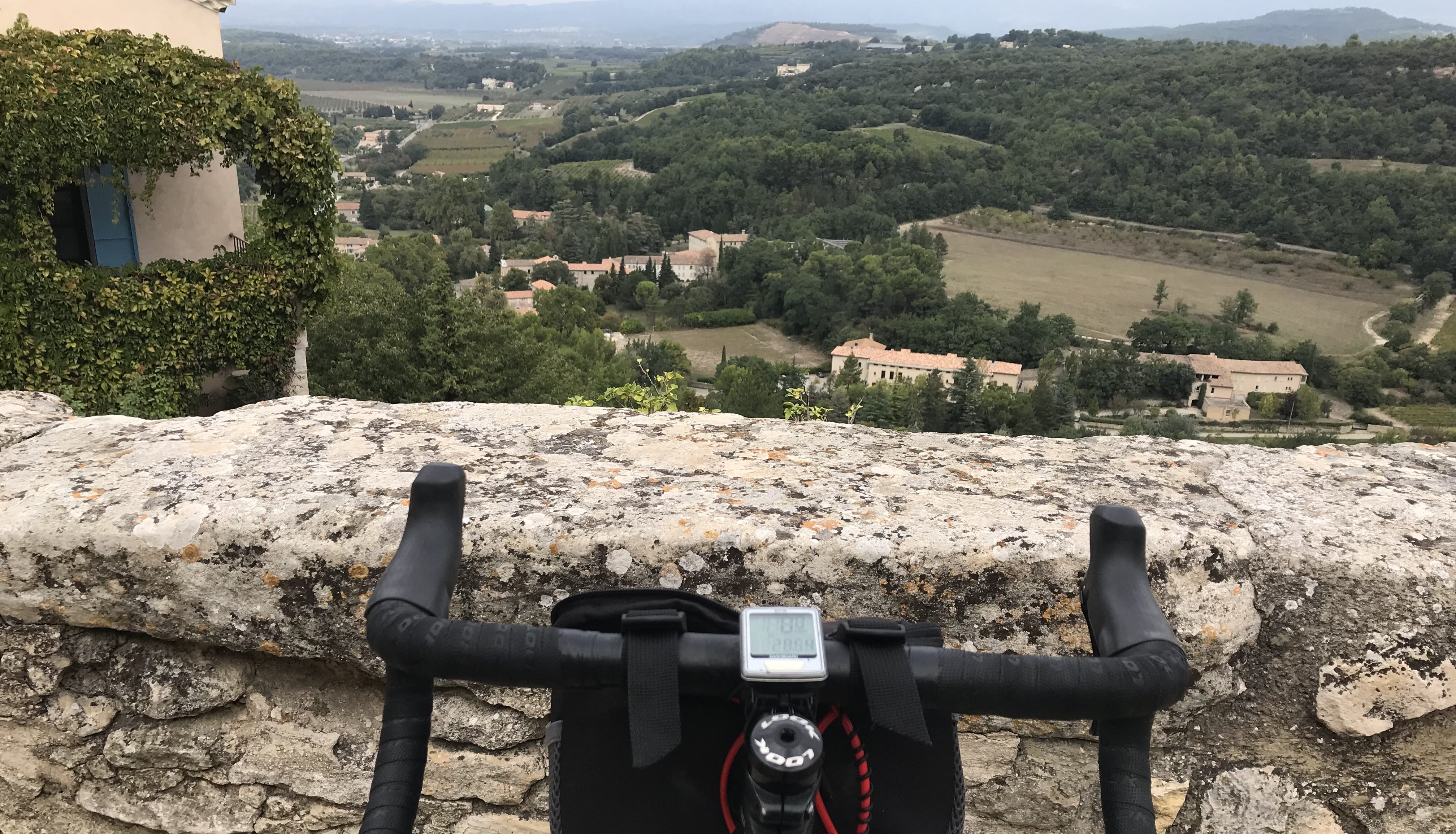
Two days ago: I headed around the lake and south on the bike trail toward Albertville, then made a right turn in the town of Faverges and started climbing the Col de Tamie – a relatively easy but scenic col (9.7 kilometers and an average gradient of 4.0). After about three kilometers I saw an old bridge up ahead. It looked interesting so I went over to investigate. A couple (a man and a woman) were strapped together and standing on the edge of the bridge. A man was giving them instructions.
They were about to bungee jump!
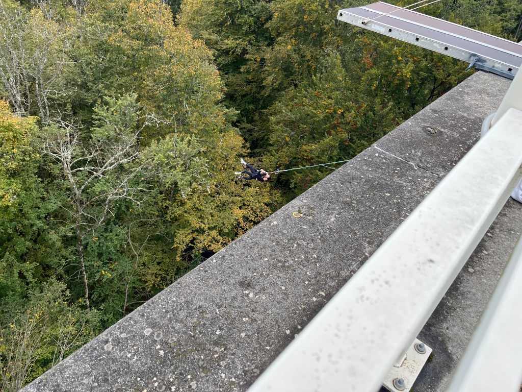
I couldn’t get my camera out of my pocket in time to get a shot of them jump, but if you look closely you can see them swinging down below the bridge. What you can’t see is them screaming. Later, when I told Susan about it she asked if I’d ever want to bungee jump. “No way, not now, but maybe when I was 25.” Then again, maybe not.
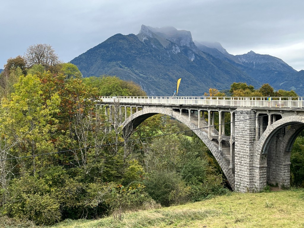
Off I went, as the couple continued to swing back and forth. And scream. I wonder how the guy at the top got them back onto the bridge. But he did, as an hour or so later, when I came back down from the summit, they were gone. Here’s a better picture of the bridge they jumped off …
I knew yesterday’s ride was most likely gonna be my last one, as an all-day rain was forecast for today, and actually happened. And so, I decided to do something epic: the Col de l’Arpettaz. It’s considered an HC, hors categorie (beyond category), climb, which means it’s so difficult they can’t categorize it. There are three categories of climbs: 1 (the hardest), then 2 and a 3 (the easiest). Why can’t they have a 4 or even a 5? They have the numbers.
There are two ways up and they’re both HC: 20.6 kilometers with a 5.8 percent gradient on the D109 or 14.5 kilometers with a 7.8 percent gradient on a road so small it doesn’t even have a number. Did they run out of road numbers?
Plus … the start of the col was 35 kilometers away. Fortunately it was all along the path, so it was pretty flat, fast and easy. But still … 35 kilometers there and then back adds up to a lot of kilometers.
I went back and forth on which road to climb. Is shorter and steeper easier than longer but not quite as steep? It’s a question for the ages. And cyclists. I couldn’t decide even as I reached the town of Ugine and the start of the monster climb. After about two kilometers the road splits. To the right was the longer, less steep D109 route, to the left was the shorter, steeper route on the road with no name. The unnamed road had a sign saying this was the route for the Col de l’Arpettaz. The D109 didn’t have a sign. This was a sign. Literally. And so, I started up the shorter, steeper route.
Was this a mistake?

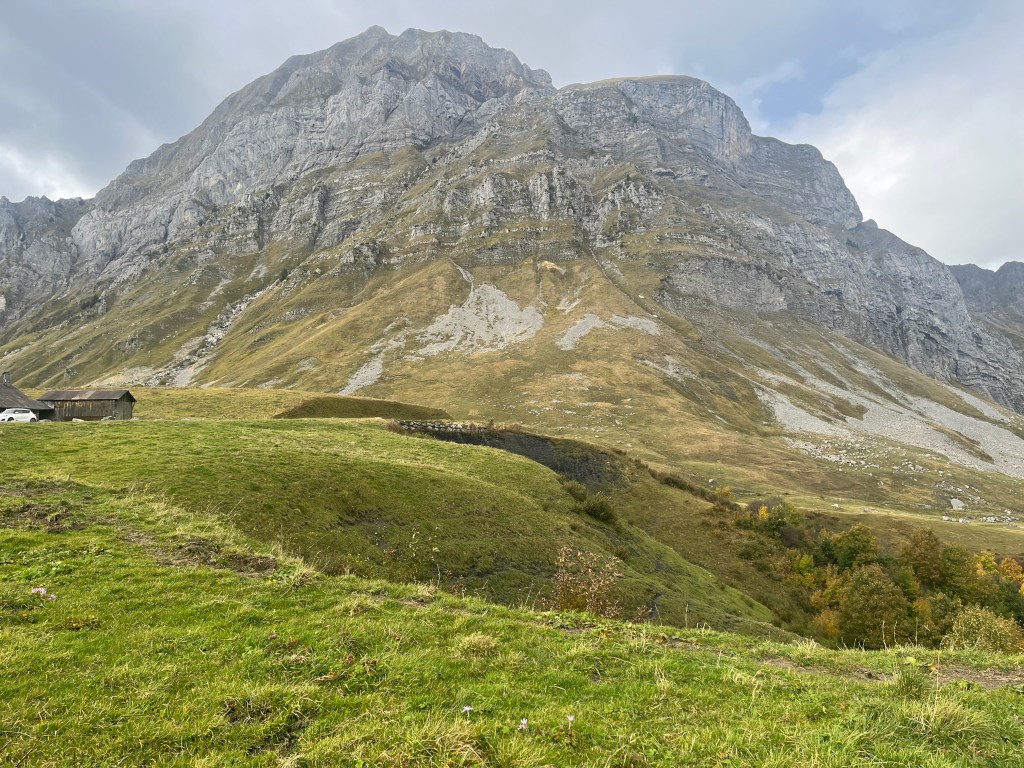
It was a killer climb from the very start, all 7-, 8- and 9-percent sections, one after the other after the other, with a seemingly endless series of S-turns. There must have been at least 30 S-turns. One good thing about S-turns: Often, at the apex, it’s fairly flat, so I could stop and catch my breath. Fortunately, the views down kept getting better and better the higher I went.
Another thing: There were no signs every kilometer telling you how many kilometers left in the climb, your current altitude and the percent grade of the next kilometer. Like there had been on every other col. At first, I thought this was a good thing, that I’d forget about how far I had to go to get to the top and the summit would magically appear well before I thought it should.
Nope, not even close.
The road kept going and going and not knowing how far I’d ridden and how far it was to the top only made it worse.
I kept going, ever so slowly and finally … the summit …
I stayed at the summit for a while, taking in the amazing views. And then it was time to ride the D109 back to Ugine. But … the first kilometer was uphill! The bastards. And then, I turned a corner and there it was, off in the distance, a shimmering, majestic vision: Mont Blanc, the tallest mountain in the Alps at 4,805 meters. The Arpettaz is “only” 1,581 meters high.

The Arpettaz was by far the toughest ride in this area, IMHO. Tougher than the Semnoz and even the legendary Col de la Colombiere, which I climbed twice in 2022 and has been in the Tour de France 23 times. The Arpettaz would be in the Tour, except … the two roads up, even the D109, are extremely narrow and not very well paved. It’s too dangerous for the Tour. Someone would fly off the side of the mountain on the downhill.
I was extremely cautious on the downhill until the final 5 kilometers, when, all of a sudden, the D109 turned into a wider, newly paved road. Caution went out the window and I hit 39.5 miles per hour according to Strava, the fastest I’ve gone on this trip.
You may be thinking what I was thinking when I got back to Ugine: There’s still 35 kilometers to go. That’s 21 miles. But what the hell, this was my last ride on this trip, so relaxed and enjoyed the long, flat, scenic ride “home.”
The totals: 70.42 miles and 4,762 feet of climbing.


Was going up the step road a mistake?
LikeLike
Nicely written. Thank you.
LikeLike