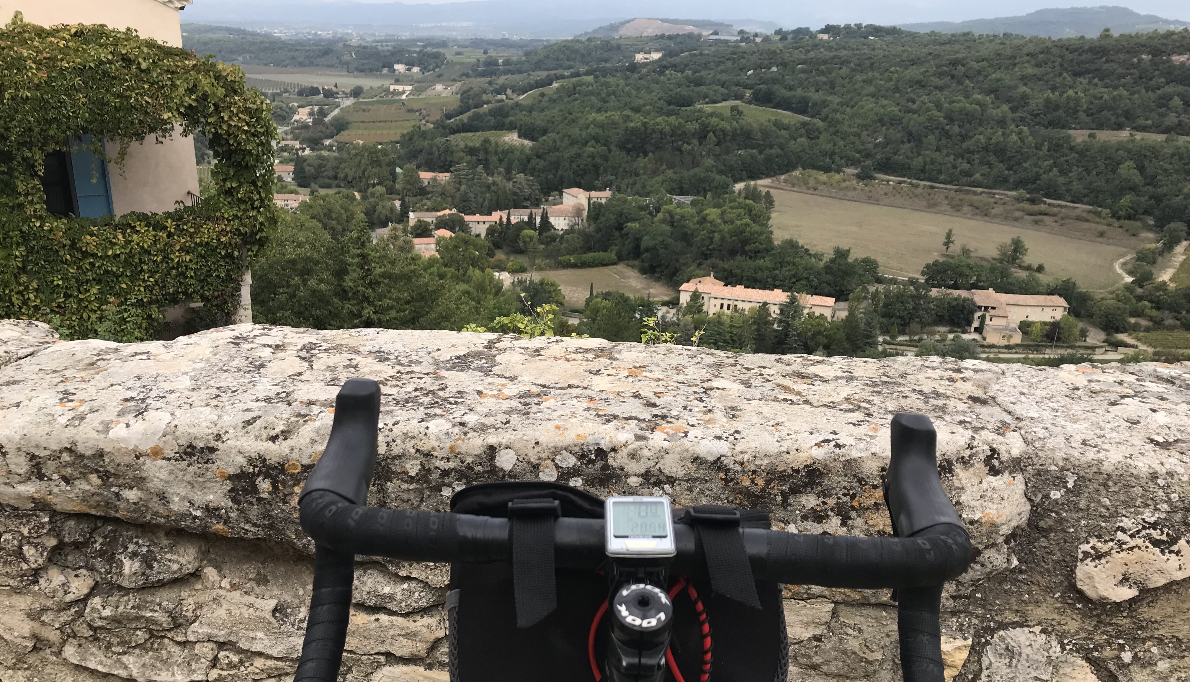

I think I’ve figured out the key to cycling here in Burgundy and it’s all about … the ridges!
Yes, ridges. Rolling ridges.
I’m not exactly sure how many ridges there are here in Burgundy, or if I’ve ridden up and down the same one several times the past few days, or if there are a whole series of different ridges here (I think it’s the latter of the two). They’re everywhere you look and seem to run north and south. But I could be wrong. The big cities, like Dijon and Beaune (where I’m staying) are down in the valleys below the cliffs and ridges and so are the vineyards, wine villages and the wine-route path (Voie des Vignes).
You could ride only in the valleys and along the canals, and I’m sure some people do. That wouldn’t be any fun or much of a challenge, right? And so, today, I went on a great 50-mile double-trouble-ridge ride. I have no idea if the ridges here have names, but this was the one that runs north and south between Dijon (to the north) and Beaune (to the south) and west of the Voie des Vignes.

I decided to take the train to the little town of Nuits-St-Georges. It’s about halfway between Beaune and Dijon. I rode here and back yesterday, along the northern section of the Voie des Vignes (Here’s the link to my previous story about the southern section). It was a relatively flat, easy and nice 38-mile ride, through vineyards and little villages. You can continue north on the Voie des Vignes all the way to Dijon, but I wanted something different today and so, from Nuits-St-Georges, I headed west toward the big ridge. According to my Michelin map (which is never wrong) it gets up to and a little above 500 meters.
I thought it would be a continuous 10 or 12 kilometers up, up, up to the top of the ridge, but actually, while it was mostly up, up, up, there were a couple flats and even a few short downhills. This meant it wasn’t as hard of a ride as I thought it would be. As I went higher, the farms changed … from vineyards to a different variety of crops, such as wheat and a few other things I didn’t recognize.
The village of Quemigny-Poisot was near the top of the ridge and then … 10 or 11 Ks downhill to the bottom of the valley and the Canal de Boourgogne that parallels the Ouche River. I flew by several cyclists on their way up this side of the ridge, which reinforced my growing notion that I’d picked the easier side to scale, and these brave cyclists were taking on the challenge of the tougher side.
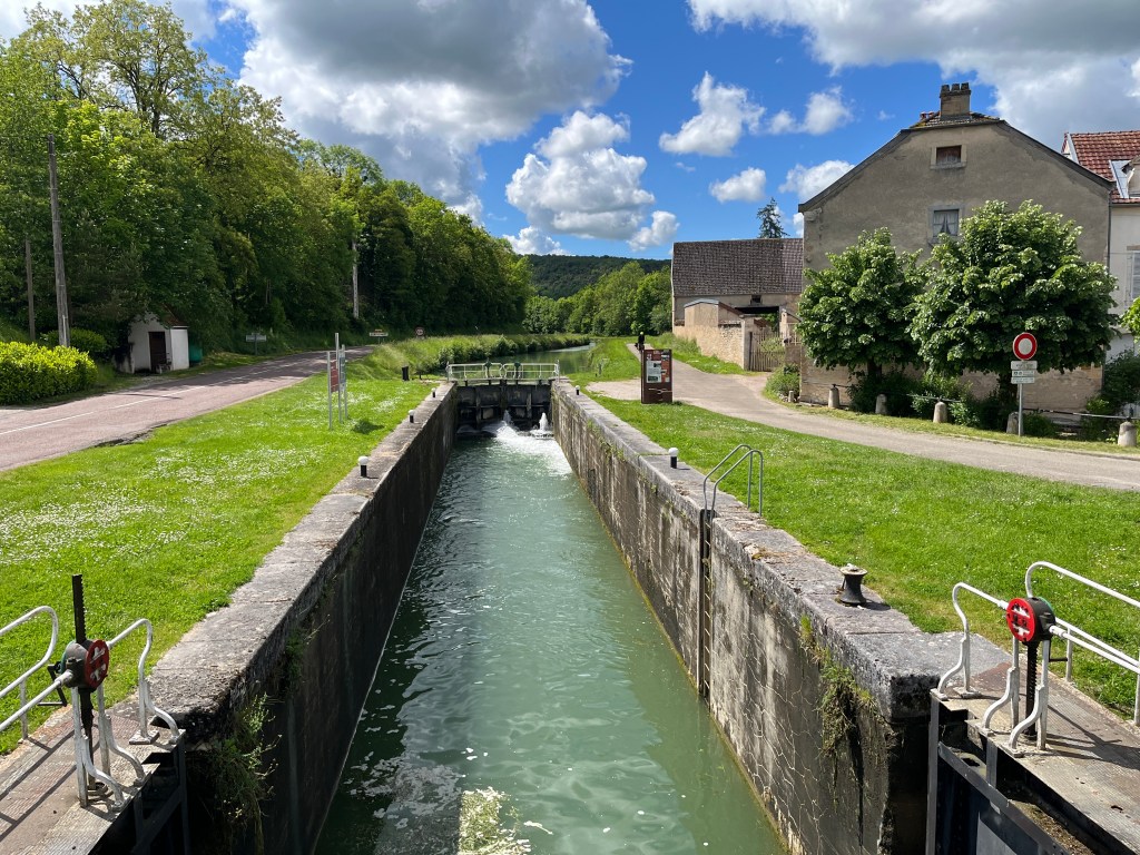
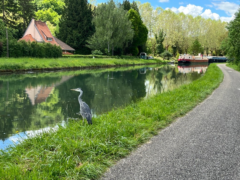
The canal was nice in a typical canal sort of way, with a lock every kilometer or so. The highlight was the cranes. There seemed to be a big blueish-white crane every kilometer or so for the 20 Ks I rode along the canal. They stood there, at the edge of the canal, craning their necks and looking at something in the water, ready to spring into action and snatch their prey. As I rode by, most of the cranes would fly off as I approached. It’s really cool to watch a crane take off. Their wings are disproportionately long and they seem to flap them in slow motion. It’s graceful and a bit balletic. This one, in the photo below, stayed put while I approached, when I stopped 20 yards away and took a photo, and carefully crept quietly closer and took more photos. He even stayed put as a jogger went by in the other direction. That’s one brave crane.
To get from the canal and back to Beaune, yep, I had to once again go up and over the ridge (the same one, I think). This time it was a much tougher climb, about 6 Ks (3.6 miles) up, up, up at a constant and average gradient (I’m guessing) of 6 or 7 percent. Finally, the summit. And then, 12 amazing Ks all the way down to the village of Savigny-les-Beaune and the final few and flat Ks back to Beaune.
All in all: 50.59 miles and 2,452 feet of climbing, with almost all the climbing on the two treks up the valley. This was a really nice ride. I’m tempted to use the word pleasant again, as I did in my first post about my initial ride here, but 50 miles of non-stop pleasantness adds up to something just below spectacular.

